
Today·Emerging
Follow-up 3h ago5
93%
Northeast Monsoon Brings Heavy Rain to South India, Relief from October Heat
The northeast monsoon is bringing heavy rain, thunderstorms and strong winds to Andhra Pradesh, Telangana and southern India from October 15–20, with yellow alerts issued for 15 Telangana districts and heavy rain warnings for Andhra Pradesh. Simultaneously, a western disturbance is causing severe weather in northern India, while several regions continue experiencing above-normal temperatures despite the changing weather systems.
Quick Facts
- Northeast monsoon onset bringing heavy rainfall
- Yellow alerts issued for thunderstorms, lightning and gusty winds
- Heavy rain warnings for coastal and Rayalaseema districts
- Western disturbance and cyclonic circulation affecting northern India
- Strong winds and hailstorms forecast



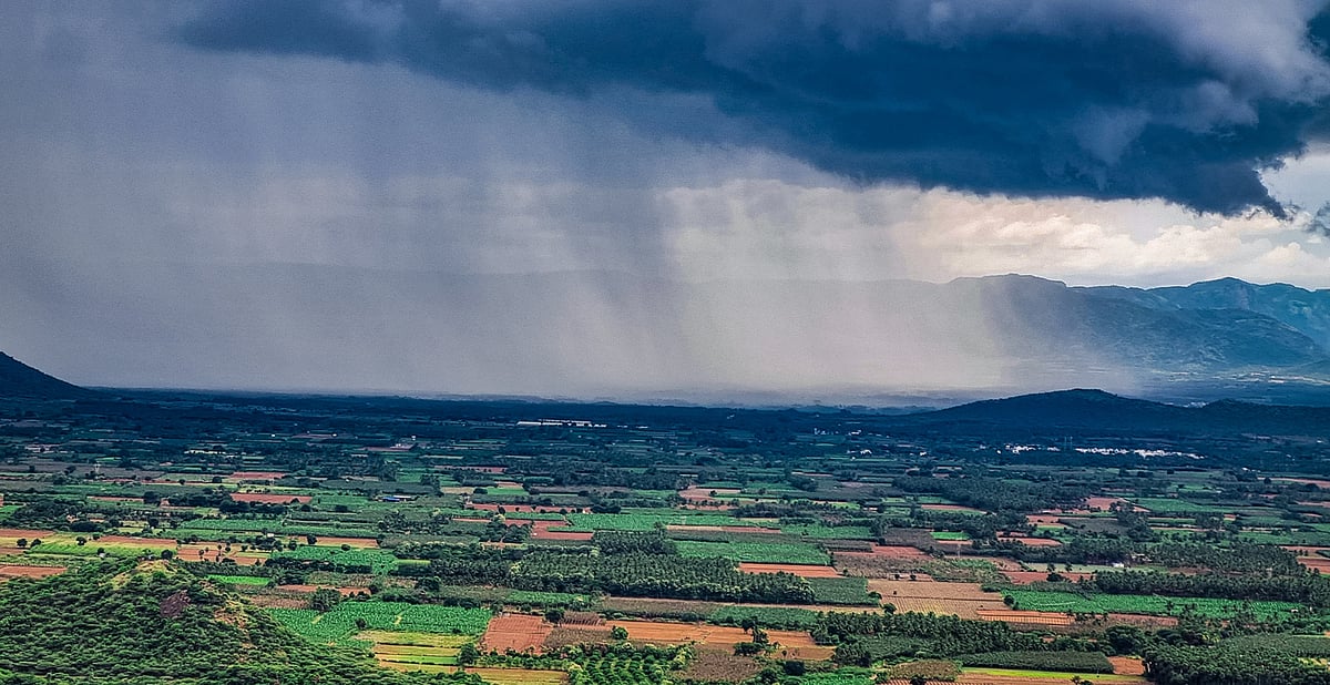
The India Meteorological Department (IMD) has issued widespread weather alerts across southern and northern India as multiple weather systems converge over the country in mid-October 2026. A trough extending from the Gulf of Mannar through the Bay of Bengal is creating favorable conditions for the northeast monsoon onset, bringing heavy rainfall, thunderstorms and strong winds to Andhra Pradesh, Telangana and other southern states from October 15 onwards.
Andhra Pradesh and Telangana are forecast to receive moderate to heavy rainfall over six days starting October 15, with the most intense activity expected October 17–19. The IMD has issued yellow alerts for 15 districts in Telangana, including Bhadradri Kothagudem, Khammam, Nalgonda, Suryapet, Mahabubabad, Warangal and Hanumakonda. In Andhra Pradesh, heavy rain warnings have been issued for coastal districts and Rayalaseema region, with isolated rainfall of 64.5–155.5 mm possible in affected areas. Strong winds of 40–50 kmph, with gusts up to 60 kmph, are expected across both states, posing risks to temporary structures, power lines and crops.
Northern India is simultaneously experiencing severe weather under the influence of a western disturbance and cyclonic circulation over northwestern Uttar Pradesh and northern Pakistan. Jammu and Kashmir, Ladakh, Himachal Pradesh, Punjab, Haryana, Chandigarh and Delhi face thunderstorms, hailstorms and heavy rainfall through October 15–17. Rainfall of 64.5–155.5 mm in mountainous areas raises risks of waterlogging and landslides. Winds of 40–50 kmph are expected in northern regions, with similar hazards to infrastructure and outdoor activities.
The southwest monsoon is withdrawing from India while the northeast monsoon approaches southern peninsular regions. Tamil Nadu, Puducherry and Karaikal are forecast to receive heavy rainfall accompanied by thunderstorms and lightning. Kerala and South Interior Karnataka may also see thunderstorms. Paradoxically, despite approaching rainfall, several regions continue to experience above-normal temperatures: Coastal Karnataka has recorded maximum temperatures more than 5.1°C above seasonal average, with similar departures reported in Assam, Meghalaya, Konkan, Goa, Vidarbha, Telangana and Kerala.
Authorities have advised precautions across affected regions. The Andhra Pradesh State Disaster Management Authority urged residents to remain alert during thunderstorms and take necessary precautions. Farmers have been advised to ensure proper field drainage, secure harvested produce and protect vulnerable crops. Residents are instructed to avoid standing under trees or near large hoardings during thunderstorms and to remain cautious in exposed areas. The IMD has clarified that current wind speeds do not warrant a ban on fishing activities, though sea conditions remain unsettled.
As the northeast monsoon establishes, maximum temperatures in southern states are expected to return to seasonal normal within two days, offering relief from the extended October heatwave that has dominated the region.
Why This Matters
The northeast monsoon and western disturbance convergence impacts 15+ districts across southern and northern India through October 20, with measurable effects on agriculture, infrastructure and public safety: isolated rainfall of 64.5–155.5 mm and winds up to 60 kmph pose verified risks to crops, power lines and temporary structures; concurrent above-normal temperatures (5.1°C+ above average in Coastal Karnataka and other regions) delay seasonal cooling, affecting water demand and heat-related public health response; farmers, fishing communities and transportation systems require operational precautions during the 6-day event window.
Timeline & Sources
Oct 14, 2026
WireIMD issues weather forecast warning of thunderstorms, hailstorms and heavy rainfall across India
Oct 15, 2026
WireYellow alerts issued for 15 districts in Telangana; heavy rain forecast begins in Mulugu, Khammam, Suryapet, Nalgonda, Nagarkurnool and Mahabubnagar districts
Oct 18, 2026
WireModerate to heavy rain forecast for many parts of South Telangana through October 20
Oct 20, 2026
WireWidespread rain event concludes; six-day rainfall period ends
Sources
- IMD forecasts heavy rainfall over J&K, Ladakh, Tamil Nadu, Puducherry & Karaikal for todayNews On AIRMediaOct 15, 2026
- Daily weather tracker: Weather takes a dramatic turn across India as storms, hailstorms and heavy rain threaten several statesDown To EarthMediaOct 14, 2026
- Andhra Pradesh, Telangana weather today: Check IMD alerts, heavy rain warning and latest forecastThe Economic TimesMediaOct 15, 2026
- Rains likely in Telugu stateshttps://www.metroindia.net/MediaOct 15, 2026
- Oct. Heat Set To Ease As Northeast Monsoon Sets InDeccan ChronicleMediaOct 14, 2026