Geo
Jun 22, 20261
73%
Severe Storms and Flash Flooding Threaten FIFA World Cup Match in Philadelphia
A First Alert for severe storms and flash flooding is in effect for Monday in Philadelphia, with potential impacts to the FIFA World Cup match between France and Iraq at Lincoln Financial Field. An approaching cold front is expected to bring torrential rain, damaging winds, and isolated tornado threats, particularly during evening hours.

Quick Facts
Who
France national football team
What
First Alert for severe storms and flash flooding issued
When
Monday afternoon and evening
Where
Philadelphia
- First Alert for severe storms and flash flooding issued
- FIFA World Cup match scheduled at Lincoln Financial Field
- Cold front approaching with high moisture levels
- Possibility of torrential downpours, damaging winds, and isolated tornadoes
- Storms expected to diminish overnight
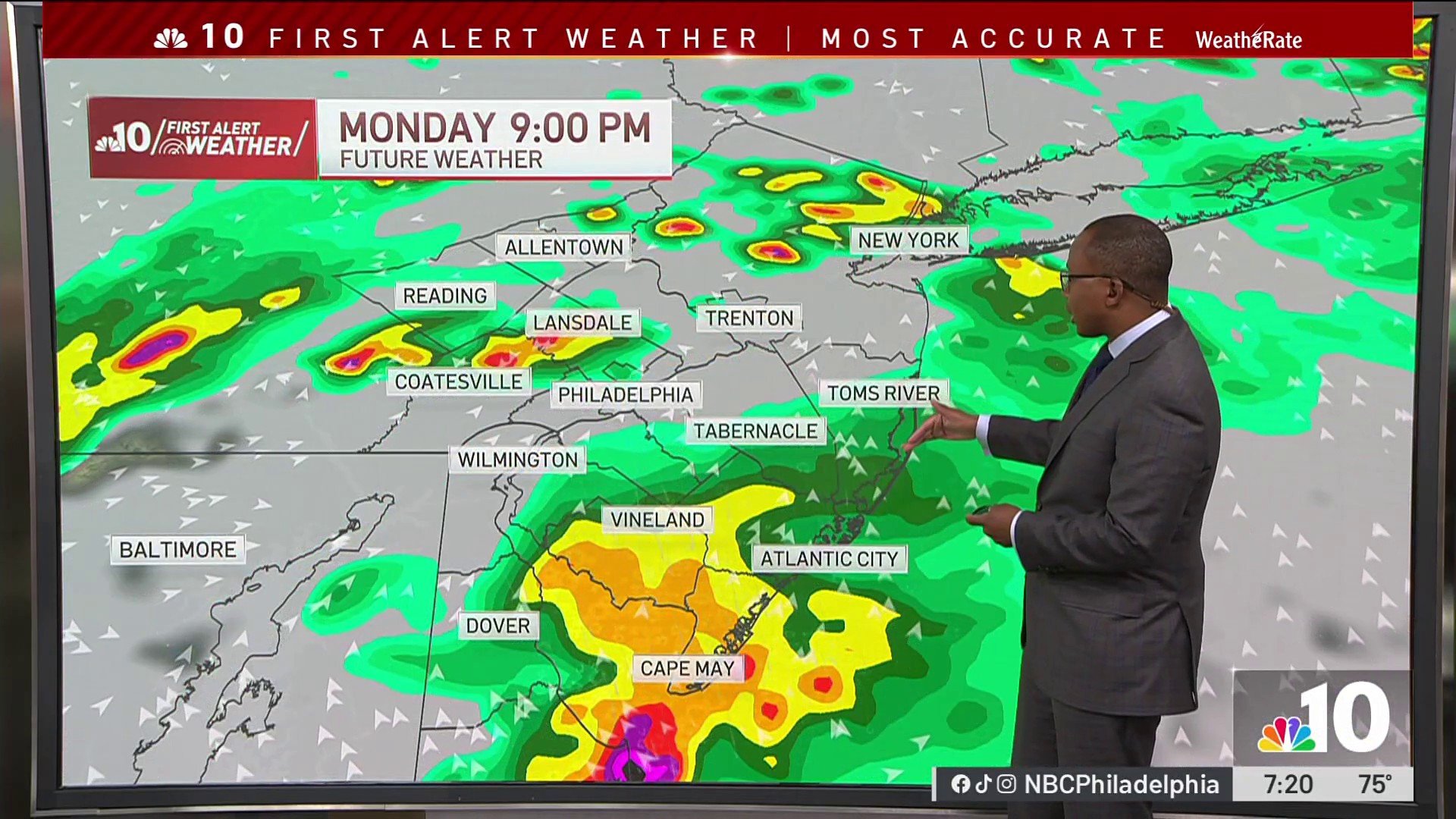
A First Alert for severe storms and flash flooding has been issued for Monday in the Philadelphia area, with the warning in effect from 3 p.m. to midnight. An approaching cold front is bringing gusty winds and very high moisture levels that are expected to fuel storm development throughout the afternoon and evening. Meteorologists warn of the possibility of torrential downpours, damaging winds, and isolated tornado threats, with the greatest risk expected during the evening hours. The storms could directly impact Monday's FIFA World Cup match between France and Iraq scheduled at Lincoln Financial Field in South Philadelphia. While a few severe thunderstorms could develop in the midafternoon, conditions are expected to worsen in the evening with widespread storms combining heavy rain, damaging wind, and tornado potential. Monday's high temperature is forecast to reach 85°. Following the storm system, conditions will gradually improve. Showers are expected to diminish overnight, though scattered showers may persist on Tuesday as the cold front slowly moves through the region, with temperatures dropping to near 80°. By mid-week, conditions will improve significantly, with partly to mostly sunny skies and low humidity expected Wednesday and Thursday, with highs in the 80s. Additional chances of showers and thunderstorms are possible returning toward the end of the week.
Why This Matters
Severe weather warnings directly threaten a high-profile FIFA World Cup match and could disrupt travel, viewing experiences, and safety for thousands of spectators and staff at Lincoln Financial Field. Understanding the timeline and intensity of storms helps residents prepare, make informed decisions about attendance, and plan alternative activities, while meteorological accuracy enables event organizers to coordinate emergency response and potential schedule adjustments.
Timeline & Sources
Jun 22, 2026
WireFirst Alert for severe storms and flash flooding begins at 3 p.m.
Jun 22, 2026
WireMidafternoon hours with possibility of a few severe thunderstorms
Jun 22, 2026
WireEvening hours with greatest threat of widespread storms, torrential rain, damaging wind, and isolated tornadoes
Jun 22, 2026
WireShowers diminish overnight; First Alert ends at midnight
Jun 23, 2026
WireTuesday with scattered showers and cold front moving through; temperatures near 80°
Jun 24, 2026
WireWednesday with partly to mostly sunny skies, low humidity, highs in 80s
Jun 25, 2026
WireThursday with nice June weather, partly to mostly sunny skies
Jun 26, 2026
WireEnd of week with return of showers and thunderstorms possible